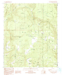
1990 Map of Gentry Mountain
USGS Topo · Published 1991About this map
Gentry Mountain dominates the northern skyline of this terrain, where the high-elevation mesas of Gila County meet the western edge of the Fort Apache Indian Reservation. The 1990 survey captures a landscape defined by water management and resource extraction, with numerous adits and prospects scattered across the slopes of Middleton Mesa and Vosburg Mesa. A isolated grave near Pine Spring and a corral on the flats of Gentry Mesa hint at the area's grazing and settlement history within the Tonto National Forest.
Find a feature on this map
50 named features on this map. Tap any name to fly to it.
Don’t see what you’re looking for? This feature index may not catch every label — zoom into the map to look around manually.
Map Details
Editions of this 1990 Gentry Mountain Map
This is the sole edition of this map. No revisions or reprints were ever made.
Other maps of this area

1886 · Holbrook
USGS Topo · 1:250,000

1893 · Holbrook
USGS Topo · 1:250,000

1922 · Chrysotile
USGS Topo · 1:125,000

1946 · Blue House Mtn
USGS Topo · 1:62,500

1949 · McFadden Peak
USGS Topo · 1:62,500

1950 · McFadden Peak
USGS Topo · 1:62,500

1951 · Blue House Mtn
USGS Topo · 1:62,500

1954 · Holbrook
USGS Topo · 1:250,000

1954 · Mesa
USGS Topo · 1:250,000

1957 · Mesa
USGS Topo · 1:250,000