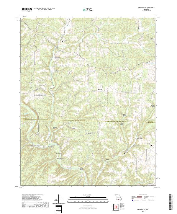
2021 Map of Gentryville
USGS Topo · Published 2021About this map
Gentryville and Blanche serve as the primary hubs in this section of the Ozarks, where the terrain is defined by a dense network of steep drainages and prominent ridges. The geography is dominated by Bryant Creek and its many tributaries, including Little Brush Cr, Spring Cr, and Trail Cr. Notable elevation points like Abrahams Knob, Simpson Mtn, and the distinctive Devils Rock Pile rise above the surrounding hollows.
Find a feature on this map
81 named features on this map. Tap any name to fly to it.
Don’t see what you’re looking for? This feature index may not catch every label — zoom into the map to look around manually.
Map Details
Editions of this 2021 Gentryville Map
This is the sole edition of this map. No revisions or reprints were ever made.
Other maps of this area

1934 · Gainesville
USGS Topo · 1:48,000

1937 · Buckhart
USGS Topo · 1:48,000

1939 · Topaz
USGS Topo · 1:62,500

1940 · Gainesville
USGS Topo · 1:62,500

1941 · Topaz
USGS Topo · 1:62,500

1943 · Buckhart
USGS Topo · 1:62,500

1944 · Cureall
USGS Topo · 1:62,500

1945 · Harrison
USGS Topo · 1:250,000

1945 · Buckhart
USGS Topo · 1:62,500

1946 · Cureall
USGS Topo · 1:62,500