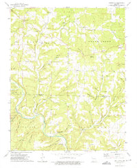
1973 Map of Gentryville
USGS Topo · Published 1975About this map
Gentryville serves as the focal point for this rural Missouri landscape, situated near the headwaters of Fox Cr in the northern portion of the quadrangle. The map documents a deeply dissected terrain characterized by numerous named hollows such as Wolfden Hol, Crenshaw Hol, and Eli Hollow, which reflect long-standing local naming traditions. In the 1970s, the area remained defined by its network of creeks, including Brush Creek and Pine Creek, and notable landmarks like Abrahams Knob and Devils Rock Pile. Genealogical value is found in the distribution of family-named burial sites, such as Henderson Cem and Hale Cem, along with community hubs like St Johns Ch and the settlement of Blanche. The map also captures the administrative boundary between Douglas Co and Ozark Co, illustrating how these remote Ozark hills were partitioned.
Find a feature on this map
42 named features on this map. Tap any name to fly to it.
Don’t see what you’re looking for? This feature index may not catch every label — zoom into the map to look around manually.
Map Details
Editions of this 1973 Gentryville Map
This is the sole edition of this map. No revisions or reprints were ever made.
Other maps of this area

1934 · Gainesville
USGS Topo · 1:48,000

1937 · Buckhart
USGS Topo · 1:48,000

1939 · Topaz
USGS Topo · 1:62,500

1940 · Gainesville
USGS Topo · 1:62,500

1941 · Topaz
USGS Topo · 1:62,500

1943 · Buckhart
USGS Topo · 1:62,500

1944 · Cureall
USGS Topo · 1:62,500

1945 · Harrison
USGS Topo · 1:250,000

1945 · Buckhart
USGS Topo · 1:62,500

1946 · Cureall
USGS Topo · 1:62,500