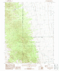
1987 Map of Georges Water
USGS Topo · Published 1988About this map
The Kawich Range dominates this high-desert landscape in Nye County, showing a complex intersection of military jurisdiction and wildlife protection in the late 1980s. The western peaks fall within the Nellis Air Force Range, a Restricted Access Area that borders the Nevada Wild Horse Management Area. This overlap of uses reflects the dual nature of the Great Basin as both a proving ground and a protected wilderness.
Find a feature on this map
14 named features on this map. Tap any name to fly to it.
Don’t see what you’re looking for? This feature index may not catch every label — zoom into the map to look around manually.
Map Details
Editions of this 1987 Georges Water Map
This is the sole edition of this map. No revisions or reprints were ever made.
Other maps of this area

1908 · Kawich
USGS Topo · 1:250,000

1942 · Reveille Peak
USGS Topo · 1:125,000

1952 · Kawich Peak
USGS Topo · 1:62,500

1952 · Quartzite Mtn
USGS Topo · 1:62,500

1952 · Reveille Peak
USGS Topo · 1:62,500

1952 · Belted Peak
USGS Topo · 1:62,500

1954 · Goldfield
USGS Topo · 1:250,000

1955 · Goldfield
USGS Topo · 1:250,000

1958 · Goldfield
USGS Topo · 1:250,000

1962 · Goldfield
USGS Topo · 1:250,000