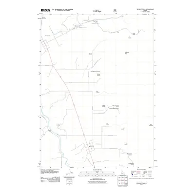
2011 Map of Georgetown
USGS Topo · Published 2011About this map
Georgetown and Bennington serve as the primary hubs in this Bear Lake County landscape, positioned along the mountain front where canyon drainages meet the valley floor. The Bear River meanders through the western portion of the quadrangle, passing near the Pescadero Siding railroad point. The terrain is defined by an intricate network of named canyons and hollows, including the branching Georgetown Canyon with its Right Hand Fork and Left Hand Fork, alongside notable peaks like Threemile Peak and Bald Mountain. Water management is evident through features such as the Welling Number Two Dam and Red Pine Canyon Dam. This 2011 survey captures the rural layout of the region, showing how local roads like Stringtown Rd, Maple Rd, and Cemetery Rd connect these agricultural settlements to the surrounding high country and landmarks like White Pass.
Find a feature on this map
48 named features on this map. Tap any name to fly to it.
Don’t see what you’re looking for? This feature index may not catch every label — zoom into the map to look around manually.
Map Details
Editions of this 2011 Georgetown Map
This is the sole edition of this map. No revisions or reprints were ever made.
Other maps of this area

1909 · Montpelier
USGS Topo · 1:125,000

1911 · Montpelier
USGS Topo · 1:125,000

1911 · Slug Creek
USGS Topo · 1:62,500

1915 · Crow Creek
USGS Topo · 1:62,500

1949 · Snowdrift Mountain
USGS Topo · 1:24,000
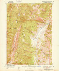
1951 · Snowdrift Mountain
USGS Topo · 1:24,000

1955 · Preston
USGS Topo · 1:250,000

1958 · Preston
USGS Topo · 1:250,000

1962 · Preston
USGS Topo · 1:250,000

1967 · Montpelier
USGS Topo · 1:24,000