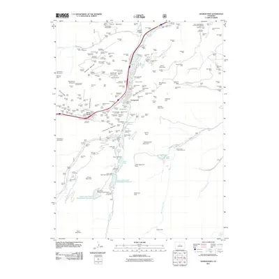
2011 Map of Georgetown
USGS Topo · Published 2011About this map
Georgetown and Silver Plume anchor this high-altitude mining district, showing the lasting imprint of the silver boom on the Colorado Front Range. The famous Georgetown Loop railroad remains a prominent feature, winding its way through the steep valley between the two settlements. This area is a dense network of historic mining claims and tunnels, with labels like the American Sisters Mine, Cleveland Tunnel Mine, and Brazil Shaft Mine dotting the slopes of Democrat Mountain and Republican Mountain.
Find a feature on this map
217 named features on this map. Tap any name to fly to it.
Don’t see what you’re looking for? This feature index may not catch every label — zoom into the map to look around manually.
Map Details
Editions of this 2011 Georgetown Map
This is the sole edition of this map. No revisions or reprints were ever made.
Other maps of this area

1903 · Georgetown
USGS Topo · 1:62,500

1905 · Central City
USGS Topo · 1:62,500

1905 · Georgetown
USGS Topo · 1:62,500

1910 · Central City
USGS Topo · 1:62,500

1912 · Central City
USGS Topo · 1:62,500

1924 · Montezuma
USGS Topo · 1:62,500

1924 · Fraser
USGS Topo · 1:62,500

1926 · Fraser
USGS Topo · 1:62,500

1926 · Montezuma
USGS Topo · 1:62,500

1933 · Montezuma
USGS Topo · 1:62,500