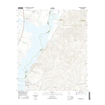
2014 Map of Georgetown
USGS Topo · Published 2014About this map
The Walter F George Reservoir dominates this interstate borderlands landscape, where the Chattahoochee River waters divide Alabama and Georgia. At the southwestern edge, the settlement of Georgetown serves as a focal point near the junction of Us-82 and Ga-39. The map details a transition from the water-oriented infrastructure of Watsons Lndg and the Lake Point Industrial Park Dr in the north at Wylaunee, to the deeply dissected terrain of the Georgia interior.
Find a feature on this map
48 named features on this map. Tap any name to fly to it.
Don’t see what you’re looking for? This feature index may not catch every label — zoom into the map to look around manually.
Map Details
Editions of this 2014 Georgetown Map
This is the sole edition of this map. No revisions or reprints were ever made.
Other maps of this area

1950 · Lumpkin SW
USGS Topo · 1:24,000

1950 · Lumpkin
USGS Topo · 1:62,500

1953 · Dothan
USGS Topo · 1:250,000

1954 · Dothan
USGS Topo · 1:250,000

1955 · Dothan
USGS Topo · 1:250,000

1955 · Lumpkin SW
USGS Topo · 1:24,000

1955 · Lumpkin
USGS Topo · 1:62,500

1955 · Phenix City
USGS Topo · 1:250,000

1957 · Phenix City
USGS Topo · 1:250,000

1958 · Phenix City
USGS Topo · 1:250,000