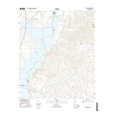
2017 Map of Georgetown
USGS Topo · Published 2017About this map
The Walter F George Reservoir dominates the western portion of this landscape, forming the natural boundary between Alabama and Georgia. On the eastern shore in Quitman County, the town of Georgetown serves as a primary hub where Old 39 Hwy and several local routes converge near the water's edge. Further north, the settlement of Wylaunee is situated near the Stewart County line, surrounded by a complex system of drainage creeks and inlets including Cool Br. The eastern half of the map is characterized by the intricate drainage networks of Bustahatchee Cr and its northern fork, while historical river access is noted at Watsons Lndg. This survey documents the modern layout of residential streets like Jacqueline Dr and McKenzie Rd against the older rural road system and shoreline features like Roberts Pond.
Find a feature on this map
51 named features on this map. Tap any name to fly to it.
Don’t see what you’re looking for? This feature index may not catch every label — zoom into the map to look around manually.
Map Details
Editions of this 2017 Georgetown Map
This is the sole edition of this map. No revisions or reprints were ever made.
Other maps of this area

1950 · Lumpkin SW
USGS Topo · 1:24,000

1950 · Lumpkin
USGS Topo · 1:62,500

1953 · Dothan
USGS Topo · 1:250,000

1954 · Dothan
USGS Topo · 1:250,000

1955 · Dothan
USGS Topo · 1:250,000

1955 · Lumpkin SW
USGS Topo · 1:24,000

1955 · Lumpkin
USGS Topo · 1:62,500

1955 · Phenix City
USGS Topo · 1:250,000

1957 · Phenix City
USGS Topo · 1:250,000

1958 · Phenix City
USGS Topo · 1:250,000