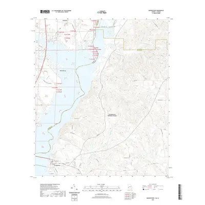
2020 Map of Georgetown
USGS Topo · Published 2020About this map
Walter F George Reservoir dominates the landscape at the Alabama and Georgia border, separating the city of Eufaula from the seat of Georgetown-Quitman County. The topography on the Georgia side is defined by a dense network of creek drainages, including Tobannee Cr, Soapstone Cr, and Bustahatchee Cr, which carve through the terrain east of the reservoir. Within Georgetown, the Quitman County Courthouse serves as a central landmark at the intersection of local routes like Middle St and McKenzie Rd. To the north, the small settlement of Wylaunee sits near the reservoir's edge, while the Bradley Dike Trail follows the engineered shoreline. This modern survey illustrates the proximity of residential development to the river-turned-reservoir, with features like Watsons Lndg and Roberts Pond highlighting the importance of the waterfront to the local geography.
Find a feature on this map
52 named features on this map. Tap any name to fly to it.
Don’t see what you’re looking for? This feature index may not catch every label — zoom into the map to look around manually.
Map Details
Editions of this 2020 Georgetown Map
This is the sole edition of this map. No revisions or reprints were ever made.
Other maps of this area

1950 · Lumpkin SW
USGS Topo · 1:24,000

1950 · Lumpkin
USGS Topo · 1:62,500

1953 · Dothan
USGS Topo · 1:250,000

1954 · Dothan
USGS Topo · 1:250,000

1955 · Dothan
USGS Topo · 1:250,000

1955 · Lumpkin SW
USGS Topo · 1:24,000

1955 · Lumpkin
USGS Topo · 1:62,500

1955 · Phenix City
USGS Topo · 1:250,000

1957 · Phenix City
USGS Topo · 1:250,000

1958 · Phenix City
USGS Topo · 1:250,000