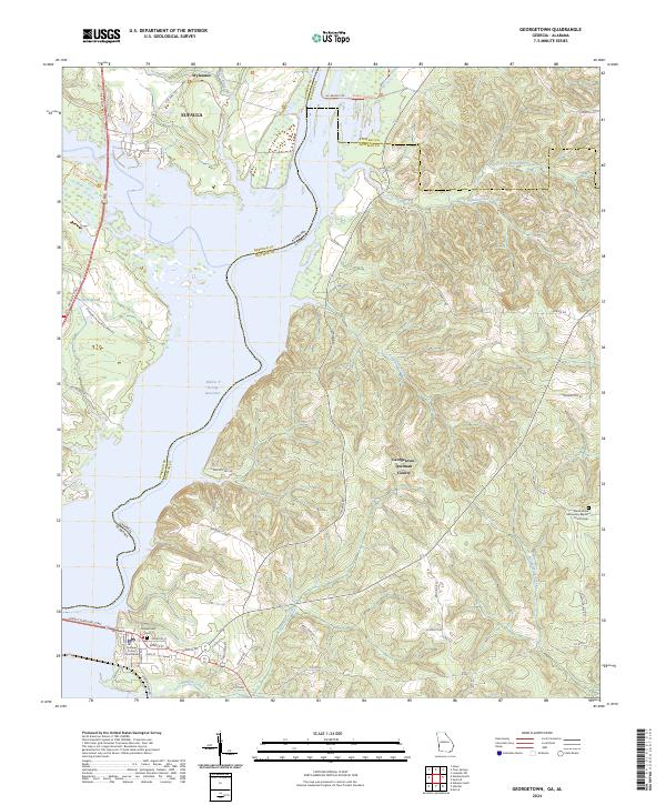
2024 Map of Georgetown
USGS Topo · Published 2024About this map
Georgetown sits at the western edge of Georgetown-Quitman County, where the modern landscape is defined by the expanse of the Walter F George Reservoir. The town center contains the Quitman County Courthouse and the nearby Georgetown Cem, reflecting its role as a local seat of government. To the north, the Eufaula National Wildlife Refuge preserves the wetlands and shores around Eufaula and Wylaunee.
Find a feature on this map
59 named features on this map. Tap any name to fly to it.
Don’t see what you’re looking for? This feature index may not catch every label — zoom into the map to look around manually.
Map Details
Editions of this 2024 Georgetown Map
This is the sole edition of this map. No revisions or reprints were ever made.
Other maps of this area

1950 · Lumpkin SW
USGS Topo · 1:24,000

1950 · Lumpkin
USGS Topo · 1:62,500

1953 · Dothan
USGS Topo · 1:250,000

1954 · Dothan
USGS Topo · 1:250,000

1955 · Dothan
USGS Topo · 1:250,000

1955 · Lumpkin SW
USGS Topo · 1:24,000

1955 · Lumpkin
USGS Topo · 1:62,500

1955 · Phenix City
USGS Topo · 1:250,000

1957 · Phenix City
USGS Topo · 1:250,000

1958 · Phenix City
USGS Topo · 1:250,000