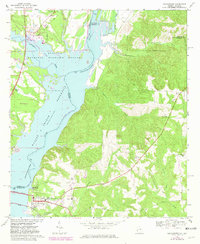
1967 Map of Georgetown
USGS Topo · Published 1981About this map
Georgetown anchors this landscape at the confluence of the Chattahoochee River and Tobannee Creek. The area is defined by the expansion of the Walter F George Reservoir, which shapes the boundary between Georgia and Alabama. In the town itself, a Water Tank, a High Sch, and the Central of Georgia rail line mark the local infrastructure.
Find a feature on this map
36 named features on this map. Tap any name to fly to it.
Don’t see what you’re looking for? This feature index may not catch every label — zoom into the map to look around manually.
Map Details
Editions of this 1967 Georgetown Map
2 editions found

Other maps of this area

1950 · Lumpkin SW
USGS Topo · 1:24,000

1950 · Lumpkin
USGS Topo · 1:62,500

1953 · Dothan
USGS Topo · 1:250,000

1954 · Dothan
USGS Topo · 1:250,000

1955 · Dothan
USGS Topo · 1:250,000

1955 · Lumpkin SW
USGS Topo · 1:24,000

1955 · Lumpkin
USGS Topo · 1:62,500

1955 · Phenix City
USGS Topo · 1:250,000

1957 · Phenix City
USGS Topo · 1:250,000

1958 · Phenix City
USGS Topo · 1:250,000