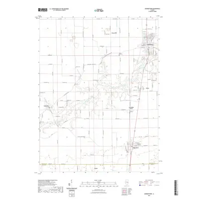
2021 Map of Georgetown
USGS Topo · Published 2021About this map
The Little Vermilion River meanders across this landscape in southeastern Vermilion County, passing just south of Georgetown. This survey illustrates a cluster of long-established communities including Indianola, Vermilion Grove, Olivet, and Ridge Farm. The area is characterized by a dense network of country roads such as Georgetown - Indianola Rd and Co Rd 900 N, connecting small hamlets like Busenville and Mabel.
Find a feature on this map
71 named features on this map. Tap any name to fly to it.
Don’t see what you’re looking for? This feature index may not catch every label — zoom into the map to look around manually.
Map Details
Editions of this 2021 Georgetown Map
This is the sole edition of this map. No revisions or reprints were ever made.
Other maps of this area

1899 · Danville
USGS Topo · 1:62,500

1900 · Danville
USGS Topo · 1:62,500

1931 · Fithian
USGS Topo · 1:48,000

1943 · Fithian
USGS Topo · 1:62,500

1947 · Ridge Farm
USGS Topo · 1:62,500

1949 · Danville SW
USGS Topo · 1:24,000

1950 · Danville SW
USGS Topo · 1:24,000

1950 · Danville SE
USGS Topo · 1:24,000

1951 · Danville SE
USGS Topo · 1:24,000

1953 · Danville
USGS Topo · 1:250,000