2024 Map of Georgetown
USGS Topo · Published 2024About this map
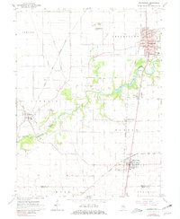
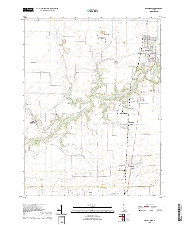
Georgetown and the surrounding agricultural townships of Vermilion County are defined by the winding course of the Little Vermilion River, which carves a dendritic drainage pattern through the central Illinois prairie. The landscape is a mix of established town grids and small unincorporated hamlets like Busenville and Mabel, connected by a dense network of country roads. The Georgetown Reservoir serves as a significant local water feature, while the river is fed by numerous named tributaries such as Fayette Drain and Swank Creek. For genealogists and local historians, the map is remarkably dense with family-named burial sites including Sandusky Cem, Michael Cem, and Crown Hill Cem, many of which sit near the historic settlements of Vermilion Grove and Indianola. The southern edge of the sheet marks the transition from Vermilion County into Edgar County, following the path of Crabapple Creek.
Find a feature on this map
126 named features on this map. Tap any name to fly to it.
Don’t see what you’re looking for? This feature index may not catch every label — zoom into the map to look around manually.
Map Details
Editions of this 2024 Georgetown Map
This is the sole edition of this map. No revisions or reprints were ever made.