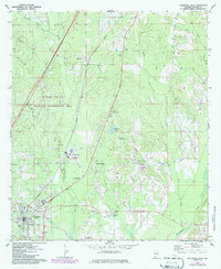
1971 Map of Georgiana East
USGS Topo · Published 1986About this map
The Seaboard railroad corridor anchors this survey of central Butler County, Alabama, connecting the northern timberlands near Bolling to the industrial and civic hubs of Chapman and Georgiana. In the southern reaches, Georgiana displays a developed grid featuring Oakwood Ave, the R L Austin High Sch, and essential infrastructure like the Armory and a Radio Tower. The map provides a detailed view of the local landscape before later modernization, highlighting the extensive Butler County Wildlife Management Area and its network of watercourses including Rocky Creek and Brushy Creek.
Find a feature on this map
42 named features on this map. Tap any name to fly to it.
Don’t see what you’re looking for? This feature index may not catch every label — zoom into the map to look around manually.
Map Details
Editions of this 1971 Georgiana East Map
3 editions found
Other maps of this area

1953 · Andalusia
USGS Topo · 1:250,000

1957 · Andalusia
USGS Topo · 1:250,000

1971 · Industry
USGS Topo · 1:24,000

1971 · Greenville West
USGS Topo · 1:24,000

1971 · Pigeon Creek
USGS Topo · 1:24,000

1971 · Mc Kenzie
USGS Topo · 1:24,000

1971 · Greenville East
USGS Topo · 1:24,000

1971 · Georgiana East
USGS Topo · 1:24,000

1971 · Garland
USGS Topo · 1:24,000

1971 · Georgiana West
USGS Topo · 1:24,000