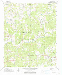
1966 Map of Gepp
USGS Topo · Published 1967About this map
Bennetts River and its tributaries carve a complex landscape across the Missouri-Arkansas border, defining the rural character of northern Fulton County in the mid-1960s. The settlement of Vidette sits at a crossroads in the west, while the village of Gepp occupies the south-central portion of the quadrangle. For genealogists, the map preserves several community burial grounds including Gobbler Trot Cem, Pickren Cem, and Hurst Cem, often situated near early church sites like Enterprise Ch. The terrain transitions from the high point at Mount Calm down to the creek bottoms of Big Creek and North Little Creek. A dense network of unimproved dirt roads and light-duty paths connects these upland farmsteads, reflecting a remote Ozark plateau economy centered on small-scale agriculture and timber well before modern expansion altered the landscape.
Find a feature on this map
30 named features on this map. Tap any name to fly to it.
Don’t see what you’re looking for? This feature index may not catch every label — zoom into the map to look around manually.
Map Details
Editions of this 1966 Gepp Map
This is the sole edition of this map. No revisions or reprints were ever made.
Other maps of this area

1890 · Mountain Home
USGS Topo · 1:125,000

1891 · Mountain Home
USGS Topo · 1:125,000

1894 · Mountain Home
USGS Topo · 1:125,000

1944 · West Plains
USGS Topo · 1:62,500

1944 · Cureall
USGS Topo · 1:62,500

1945 · Harrison
USGS Topo · 1:250,000

1946 · West Plains
USGS Topo · 1:62,500

1946 · Cureall
USGS Topo · 1:62,500

1949 · Harrison
USGS Topo · 1:250,000

1950 · Salem
USGS Topo · 1:62,500