
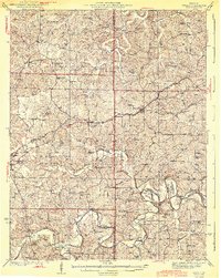
1944 Map of Gerald
USGS Topo · Published 1944About this map
Gerald and Rosebud anchor this survey of the northern Missouri hill country during the early 1940s, a landscape defined by the winding course of the Bourbeuse River. The Chicago Rock Island and Pacific railroad cuts a diagonal path through the terrain, connecting small rural centers while the Iron Road and Antioch Road provide terrestrial links through the ridges. This map reveals a high density of rural institutions, such as Drake Ch, St Jacobs Ch, and New Salem Ch, which served as social hubs for the surrounding farmsteads.
Find a feature on this map
63 named features on this map. Tap any name to fly to it.
Don’t see what you’re looking for? This feature index may not catch every label — zoom into the map to look around manually.
Map Details
Editions of this 1944 Gerald Map
2 editions found
Other maps of this area

1890 · Hermann
USGS Topo · 1:125,000

1890 · Fulton
USGS Topo · 1:125,000

1903 · Sullivan
USGS Topo · 1:125,000

1934 · Bland
USGS Topo · 1:62,500

1934 · Redbird
USGS Topo · 1:62,500

1935 · Gerald
USGS Topo · 1:48,000

1935 · Morrison
USGS Topo · 1:48,000

1936 · Hermann
USGS Topo · 1:48,000

1937 · Bland
USGS Topo · 1:62,500

1938 · Redbird
USGS Topo · 1:62,500