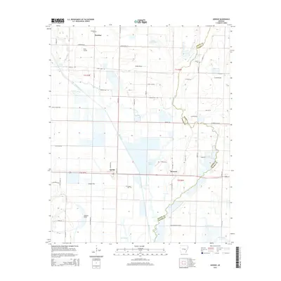
2014 Map of Geridge
USGS Topo · Published 2014About this map
Bayou Meto and Bayou Two Prairie define the drainage of this East Arkansas landscape, marking the transition between the fertile bottomlands and the famed Grand Prairie. The area is characterized by vast flats like Catalpa Flat and Long Prairie, which supported the region's historical rice and timber economies. The map centers on the rural communities of Geridge and Brummitt, where the Lonoke and Prairie county lines converge near several small family and community burial grounds, including Hamilton Cem and Geridge Cem.
Find a feature on this map
58 named features on this map. Tap any name to fly to it.
Don’t see what you’re looking for? This feature index may not catch every label — zoom into the map to look around manually.
Map Details
Editions of this 2014 Geridge Map
This is the sole edition of this map. No revisions or reprints were ever made.
Other maps of this area

1935 · Altheimer
USGS Topo · 1:62,500

1937 · Stuttgart
USGS Topo · 1:62,500

1937 · England
USGS Topo · 1:48,000

1939 · Stuttgart
USGS Topo · 1:62,500

1941 · Goldman
USGS Topo · 1:62,500

1943 · England
USGS Topo · 1:62,500

1948 · Helena
USGS Topo · 1:250,000

1950 · Helena
USGS Topo · 1:250,000

1955 · Helena
USGS Topo · 1:250,000

1959 · Helena
USGS Topo · 1:250,000