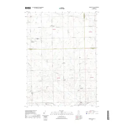
2018 Map of German Valley
USGS Topo · Published 2018About this map
German Valley and the surrounding agricultural landscape of Ogle and Stephenson Counties are defined by the winding course of the Leaf River and its tributaries. The terrain is dotted with small, long-established settlements such as Egan, Lightsville, and Adeline, each serving as a local hub for the farming community. A striking concentration of religious and genealogical sites is evident across the township lines, including the Ridott Christian Cem, Silver Creek Cem, and both the North Grove Christian Cem and North Grove Evangelical Cem. These landmarks, along with many family-named cemeteries, speak to the deep-rooted immigrant heritage of the region. The map also captures modern land use, featuring the Rock Cut Farms Airport south of Leaf River, illustrating how aviation has integrated into the rural Illinois prairie alongside traditional landmarks like Bunker Hill.
Find a feature on this map
50 named features on this map. Tap any name to fly to it.
Don’t see what you’re looking for? This feature index may not catch every label — zoom into the map to look around manually.
Map Details
Editions of this 2018 German Valley Map
This is the sole edition of this map. No revisions or reprints were ever made.
Other maps of this area

1922 · Oregon
USGS Topo · 1:62,500

1924 · Oregon
USGS Topo · 1:62,500

1932 · Pecatonica
USGS Topo · 1:62,500

1936 · Pecatonica
USGS Topo · 1:62,500

1939 · Freeport
USGS Topo · 1:48,000

1942 · Forreston
USGS Topo · 1:62,500

1944 · Freeport
USGS Topo · 1:62,500

1945 · Forreston
USGS Topo · 1:62,500

1954 · Rockford
USGS Topo · 1:250,000

1955 · Rockford
USGS Topo · 1:250,000