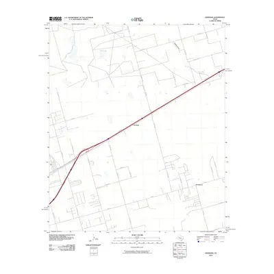
2010 Map of Germania
USGS Topo · Published 2010About this map
Germania and Greenwood anchor this section of the Permian Basin, where the landscape is defined by the geometric precision of the Texas land grid and a network of county roads. The settlement pattern here is characterized by sparse homesteads and agricultural plots, intersected by the prominent corridor of E Hwy 80. To the north, the natural topography asserts itself through the shallow depression of Salt Lake and the meandering path of Mustang Draw, providing a sharp contrast to the straight-line industrial and transportation infrastructure. This 2010 survey reflects the modern rural character of Midland County, showing how established routes like Fm 1208 and Fm 307 continue to connect these persistent small communities to the broader region.
Find a feature on this map
34 named features on this map. Tap any name to fly to it.
Don’t see what you’re looking for? This feature index may not catch every label — zoom into the map to look around manually.
Map Details
Editions of this 2010 Germania Map
This is the sole edition of this map. No revisions or reprints were ever made.
Other maps of this area

1954 · Hobbs
USGS Topo · 1:250,000

1954 · Pecos
USGS Topo · 1:250,000

1954 · Big Spring
USGS Topo · 1:250,000

1954 · San Angelo
USGS Topo · 1:250,000

1957 · Pecos
USGS Topo · 1:250,000

1958 · San Angelo
USGS Topo · 1:250,000

1958 · Big Spring
USGS Topo · 1:250,000

1958 · Hobbs
USGS Topo · 1:250,000

1965 · San Angelo
USGS Topo · 1:250,000

1965 · Southeast Midland
USGS Topo · 1:24,000