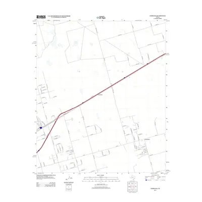
2012 Map of Germania
USGS Topo · Published 2012About this map
Germania and the surrounding plains of Midland County are defined by a grid-like network of rural roads and the diagonal passage of E Hwy-80. This landscape, recorded just after the first decade of the millennium, illustrates the transition from traditional ranching lands to a more structured suburban and industrial footprint near the Permian Basin. To the southeast, the settlement of Greenwood serves as a local hub, anchored by its proximity to FM-307. The presence of Salt Lake in the northwest quadrant provides a rare natural landmark amidst the surveyed tracts, which are divided by numerous county routes including E Co Rd-55 and E Co Rd-105. This network of roads, many bearing numerical designations, highlights the systematic development of the West Texas oil and cattle country during this era.
Find a feature on this map
81 named features on this map. Tap any name to fly to it.
Don’t see what you’re looking for? This feature index may not catch every label — zoom into the map to look around manually.
Map Details
Editions of this 2012 Germania Map
This is the sole edition of this map. No revisions or reprints were ever made.
Other maps of this area

1954 · Hobbs
USGS Topo · 1:250,000

1954 · Pecos
USGS Topo · 1:250,000

1954 · Big Spring
USGS Topo · 1:250,000

1954 · San Angelo
USGS Topo · 1:250,000

1957 · Pecos
USGS Topo · 1:250,000

1958 · San Angelo
USGS Topo · 1:250,000

1958 · Big Spring
USGS Topo · 1:250,000

1958 · Hobbs
USGS Topo · 1:250,000

1965 · San Angelo
USGS Topo · 1:250,000

1965 · Southeast Midland
USGS Topo · 1:24,000