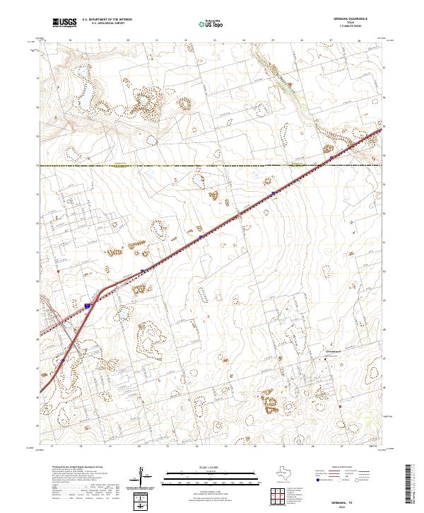
2022 Map of Germania
USGS Topo · Published 2022About this map
Greenwood serves as the primary hub of this West Texas landscape, where the residential grids and the Greenwood Cem mark the local heritage of the area. The landscape is defined by the high plains of the Permian Basin, split by the Martin Co Midland Co boundary line. Drainage patterns are dominated by the ephemeral Mustang Draw and the distinctive Salt Lake, which punctuate the arid terrain. Transportation infrastructure is central to the area's layout, with E State Hwy 80 and E Loop 250 N providing critical connectivity to the surrounding region. The map reveals a dense network of county roads, such as Ranch Rd 307 and Co Rd 2100, reflecting the organized land division and the ongoing expansion of rural and suburban developments.
Find a feature on this map
51 named features on this map. Tap any name to fly to it.
Don’t see what you’re looking for? This feature index may not catch every label — zoom into the map to look around manually.
Map Details
Editions of this 2022 Germania Map
This is the sole edition of this map. No revisions or reprints were ever made.
Other maps of this area

1954 · Hobbs
USGS Topo · 1:250,000

1954 · Pecos
USGS Topo · 1:250,000

1954 · Big Spring
USGS Topo · 1:250,000

1954 · San Angelo
USGS Topo · 1:250,000

1957 · Pecos
USGS Topo · 1:250,000

1958 · San Angelo
USGS Topo · 1:250,000

1958 · Big Spring
USGS Topo · 1:250,000

1958 · Hobbs
USGS Topo · 1:250,000

1965 · San Angelo
USGS Topo · 1:250,000

1965 · Southeast Midland
USGS Topo · 1:24,000