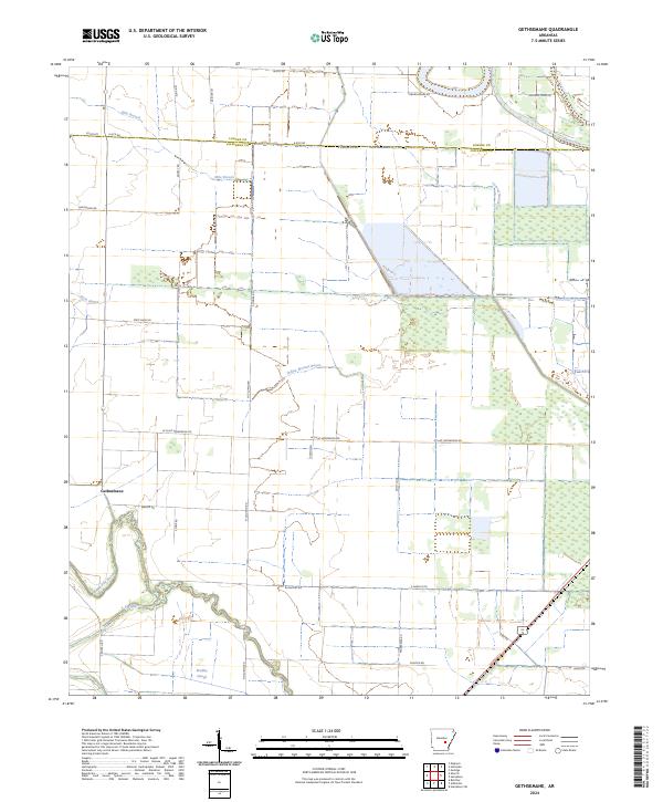
2024 Map of Gethsemane
USGS Topo · Published 2024About this map
Gethsemane anchors this modern survey of the Arkansas Delta, where the landscape is defined by an intricate network of drainage channels and historic watercourses. The territory is dominated by the winding paths of Wabbbaseka Bayou and Flat Bayou, which snake through the southern reaches near Bradley Slough. These natural waterways are joined by engineered features like Lateral Number 8, illustrating the region's long-standing reliance on sophisticated water management to support its agricultural character.
Find a feature on this map
43 named features on this map. Tap any name to fly to it.
Don’t see what you’re looking for? This feature index may not catch every label — zoom into the map to look around manually.
Map Details
Editions of this 2024 Gethsemane Map
This is the sole edition of this map. No revisions or reprints were ever made.
Other maps of this area

1935 · Altheimer
USGS Topo · 1:62,500

1937 · Stuttgart
USGS Topo · 1:62,500

1937 · England
USGS Topo · 1:48,000

1939 · Stuttgart
USGS Topo · 1:62,500

1941 · Goldman
USGS Topo · 1:62,500

1943 · England
USGS Topo · 1:62,500

1948 · Helena
USGS Topo · 1:250,000

1950 · Helena
USGS Topo · 1:250,000

1955 · Helena
USGS Topo · 1:250,000

1959 · Helena
USGS Topo · 1:250,000