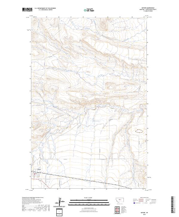
2024 Map of Geyser
USGS Topo · Published 2024About this map
The settlement of Geyser sits at the southwestern edge of this Central Montana landscape, where the street grid of Main St, Hill Ave, and Railroad Ave meets the open drainage systems of the Judith Basin. This map illustrates a transition from the structured township lines of t17n r10e to a complex network of seasonal watercourses and coulees. Water management is central to the land's utility, evidenced by named sources like Big Flat Spring and the winding path of Arrow Creek. The drainage patterns, including Dipping Vat Creek and Lone Tree Creek, suggest a history of ranching and livestock movement through the breaks. Secondary routes like Spring Meadow Rd and Big Sky Rd connect isolated homesteads to the village center, tracing the contours of a topography defined more by its creek beds than by elevation peaks.
Find a feature on this map
32 named features on this map. Tap any name to fly to it.
Don’t see what you’re looking for? This feature index may not catch every label — zoom into the map to look around manually.
Map Details
Editions of this 2024 Geyser Map
This is the sole edition of this map. No revisions or reprints were ever made.
Other maps of this area

1890 · Fort Benton
USGS Topo · 1:250,000

1892 · Fort Benton
USGS Topo · 1:250,000

1897 · Fort Benton
USGS Topo · 1:250,000

1954 · Great Falls
USGS Topo · 1:250,000

1957 · Great Falls
USGS Topo · 1:250,000
1961 · The Arch
USGS Topo · 1:24,000

1961 · Barker
USGS Topo · 1:62,500

1978 · Arrow Peak
USGS Topo · 1:24,000

1978 · Leiberg Coulee
USGS Topo · 1:24,000
1978 · Byrne Creek
USGS Topo · 1:24,000