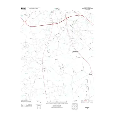
2013 Map of Ghio
USGS Topo · Published 2013About this map
Ghio Scholl Station serves as a central focal point in this 2013 survey of the North Carolina-South Carolina borderlands. The landscape is defined by an intricate network of waterways and agricultural features, including Wilva Fruit Farm and several named ponds such as Roscoe Pond and Pate Pond. The hydrology of the region is particularly detailed, with Lightwood Knot Cr, Marks Cr, and Naked Cr winding through the terrain. Small community clusters like Steen Town and Green Pond are connected by a dense grid of local roads, such as Gin Mill Rd and Oak Ridge Church Rd, reflecting the long-standing rural development patterns of Richmond County and its neighbors. The map also captures specialized sites like Camp Pee Dee Pond Number Two, illustrating the diverse land use in this border region during the early 21st century.
Find a feature on this map
129 named features on this map. Tap any name to fly to it.
Don’t see what you’re looking for? This feature index may not catch every label — zoom into the map to look around manually.
Map Details
Editions of this 2013 Ghio Map
This is the sole edition of this map. No revisions or reprints were ever made.
Other maps of this area

1942 · Rockingham
USGS Topo · 1:125,000

1949 · Gibson
USGS Topo · 1:24,000

1949 · Ghio
USGS Topo · 1:24,000

1949 · Marston
USGS Topo · 1:24,000

1949 · Hamlet
USGS Topo · 1:24,000

1949 · Hamlet
USGS Topo · 1:62,500

1953 · Florence
USGS Topo · 1:250,000

1954 · Florence
USGS Topo · 1:250,000
1956 · Rockingham
USGS Topo · 1:24,000
1957 · Hamlet
USGS Topo · 1:24,000