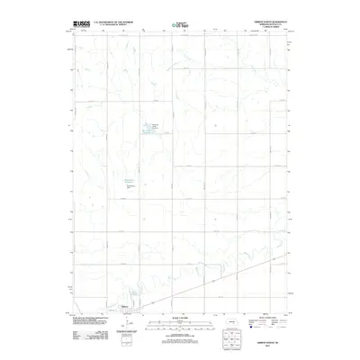
2011 Map of Gibbon North
USGS Topo · Published 2011About this map
The settlement of Gibbon anchors the southwestern corner of this Nebraska landscape, where the Wood River meanders through the fertile plains of Buffalo County. This modern survey illustrates the systematic grid of the American West, defined by a network of local thoroughfares such as Pawnee Rd, Range Rd, and the uniquely named Sodtown Rd. These routes facilitate access to a terrain shaped by agricultural water management, most notably the Box Elder Creek Reservoir 5-A and its corresponding Box Elder Creek Dam 5-A.
Find a feature on this map
25 named features on this map. Tap any name to fly to it.
Don’t see what you’re looking for? This feature index may not catch every label — zoom into the map to look around manually.
Map Details
Editions of this 2011 Gibbon North Map
This is the sole edition of this map. No revisions or reprints were ever made.
Other maps of this area

1894 · Kenesaw
USGS Topo · 1:62,500

1894 · Minden
USGS Topo · 1:62,500

1895 · Wood River
USGS Topo · 1:62,500

1896 · Wood River
USGS Topo · 1:125,000

1955 · Grand Island
USGS Topo · 1:250,000

1957 · Grand Island
USGS Topo · 1:250,000

1958 · Grand Island
USGS Topo · 1:250,000

1962 · Denman
USGS Topo · 1:24,000

1962 · Newark
USGS Topo · 1:24,000
1962 · Cameron
USGS Topo · 1:24,000