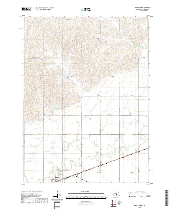
2021 Map of Gibbon North
USGS Topo · Published 2021About this map
Gibbon sits along the southern edge of this Buffalo County landscape, where the agricultural plains meet the winding path of the Wood River. The terrain north of the settlement is defined by a dense network of sectional roads, including Gibbon Rd, Sodtown Rd, and Pawnee Rd, which organize the rolling hills and drainage basins of the Platte River valley. Water management is a central feature of this rural area, evidenced by the Rhoadarmer Reservoir and Box Elder Cr Reservoir 5-A, which capture runoff from the intermittent creek beds. In the northern reaches, Prairie Cr meanders through the breaks below Pole Line Rd, illustrating the transition from the river bottomlands to the upland prairie. The grid-like precision of these roads and reservoirs reflects a deeply managed agricultural environment, essential for farming in central Nebraska.
Find a feature on this map
32 named features on this map. Tap any name to fly to it.
Don’t see what you’re looking for? This feature index may not catch every label — zoom into the map to look around manually.
Map Details
Editions of this 2021 Gibbon North Map
This is the sole edition of this map. No revisions or reprints were ever made.
Other maps of this area

1894 · Kenesaw
USGS Topo · 1:62,500

1894 · Minden
USGS Topo · 1:62,500

1895 · Wood River
USGS Topo · 1:62,500

1896 · Wood River
USGS Topo · 1:125,000

1955 · Grand Island
USGS Topo · 1:250,000

1957 · Grand Island
USGS Topo · 1:250,000

1958 · Grand Island
USGS Topo · 1:250,000

1962 · Denman
USGS Topo · 1:24,000

1962 · Newark
USGS Topo · 1:24,000
1962 · Cameron
USGS Topo · 1:24,000