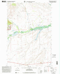
1997 Map of Gibbons School
USGS Topo · Published 2002About this map
Mussigbrod Creek descends through high Montana valley lands toward the meandering marshlands of the North Fork Big Hole River, illustrating the ranching and educational foundations of late-20th-century Beaverhead County. The map documents a landscape defined by large family holdings, including the Parsons Ranch, Gallup Ranch, and the Tope Ranch. At the heart of this rural network stands the Gibbons Sch and the small settlement of Gibbons, serving as the community hub for scattered residents like Ray Bacon and M Heggelund. Across the southern reach of the quadrangle, the Lewis and Clark National Historic Trail follows a path through the valley, anchoring the region's ranching present to its deep western heritage. The western edge is bounded by the timbered slopes of the Beaverhead National Forest, while the river plains are marked by irrigation wells and wetlands.
Find a feature on this map
24 named features on this map. Tap any name to fly to it.
Don’t see what you’re looking for? This feature index may not catch every label — zoom into the map to look around manually.
Map Details
Editions of this 1997 Gibbons School Map
This is the sole edition of this map. No revisions or reprints were ever made.
Other maps of this area

1955 · Dillon
USGS Topo · 1:250,000

1957 · Dillon
USGS Topo · 1:250,000

1958 · Dillon
USGS Topo · 1:250,000

1962 · Dillon
USGS Topo · 1:250,000

1962 · Wisdom
USGS Topo · 1:24,000

1962 · Mud Lake
USGS Topo · 1:24,000

1962 · Pintlar Lake
USGS Topo · 1:24,000

1965 · Dillon
USGS Topo · 1:250,000

1966 · Gibbons School
USGS Topo · 1:24,000

1966 · Big Hole Battlefield
USGS Topo · 1:24,000