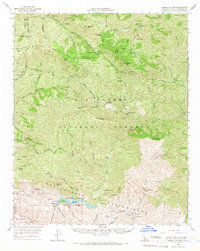
1964 Map of Gibraltar Dam
USGS Topo · Published 1966About this map
Gibraltar Reservoir serves as the focal point for this mid-1960s study of the San Rafael Mountains and its surrounding wilderness. The infrastructure of the Los Padres National Forest is well-documented, featuring essential outposts such as Happy Hollow Guard Station and Madulce Guard Sta, alongside the remote Ogilvy Ranch. The map highlights a landscape managed for both water resources and wildlife protection, specifically noting the Sisquoc Condor Sanctuary near the Sisquoc River.
Find a feature on this map
56 named features on this map. Tap any name to fly to it.
Don’t see what you’re looking for? This feature index may not catch every label — zoom into the map to look around manually.
Map Details
Editions of this 1964 Gibraltar Dam Map
2 editions found
Other maps of this area

1902 · Santa Ynez
USGS Topo · 1:125,000

1903 · Mt. Pinos
USGS Topo · 1:125,000

1904 · Ventura
USGS Topo · 1:62,500

1905 · Santa Ynez
USGS Topo · 1:125,000

1941 · Ventura
USGS Topo · 1:62,500

1941 · San Rafael Mtn.
USGS Topo · 1:62,500

1941 · McPherson Peak
USGS Topo · 1:62,500

1942 · Goleta
USGS Topo · 1:62,500

1942 · San Rafael Mtn.
USGS Topo · 1:62,500

1942 · Little Pine Mountain
USGS Topo · 1:24,000