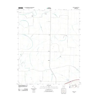
2011 Map of Gieseck
USGS Topo · Published 2011About this map
The Saint Francis River winds through the northern portion of this landscape, carving a delta terrain defined by an intricate network of oxbows and sloughs. Settlement patterns in this 2011 survey are largely concentrated along the north-south axis of Highway 75, connecting the small communities of Riverside, Duvall, Gieseck, and Gladden. This alignment reflects the historical development of the region's agricultural interior, where land use is partitioned by a grid of rural roads such as Duval Rd and Gieseck Rd.
Find a feature on this map
46 named features on this map. Tap any name to fly to it.
Don’t see what you’re looking for? This feature index may not catch every label — zoom into the map to look around manually.
Map Details
Editions of this 2011 Gieseck Map
This is the sole edition of this map. No revisions or reprints were ever made.
Other maps of this area

1939 · Edmondson
USGS Topo · 1:62,500

1940 · Deckerville
USGS Topo · 1:62,500

1940 · Princedale
USGS Topo · 1:62,500

1940 · Whitmore
USGS Topo · 1:62,500

1953 · Memphis
USGS Topo · 1:250,000

1954 · Edmondson
USGS Topo · 1:62,500

1956 · Memphis
USGS Topo · 1:250,000

1956 · Whitmore
USGS Topo · 1:62,500

1956 · Princedale
USGS Topo · 1:62,500

1957 · Deckerville
USGS Topo · 1:62,500