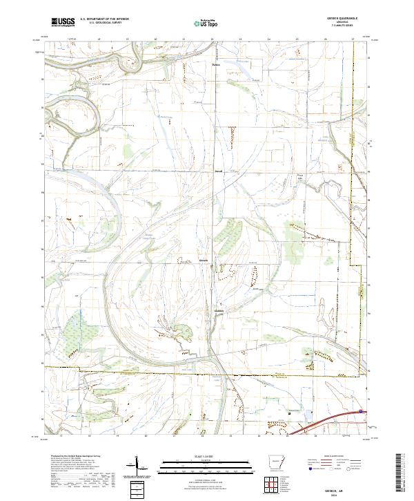
2024 Map of Gieseck
USGS Topo · Published 2024About this map
The Saint Francis River winds through the northwestern corner of this landscape, defining a region where the low-lying terrain of the Arkansas Delta is shaped by numerous sloughs, lakes, and bayous. The settlement of Parkin sits near the river's edge, serving as a focal point for a network of rural roads that connect smaller communities like Duvall, Gieseck, and Gladden. This area exhibits a typical Delta drainage pattern, where water bodies such as Walnut Timber Lake, Patterson Lake, and Little Blackfish Lake are scattered across the agricultural plains.
Find a feature on this map
53 named features on this map. Tap any name to fly to it.
Don’t see what you’re looking for? This feature index may not catch every label — zoom into the map to look around manually.
Map Details
Editions of this 2024 Gieseck Map
This is the sole edition of this map. No revisions or reprints were ever made.
Other maps of this area

1939 · Edmondson
USGS Topo · 1:62,500

1940 · Deckerville
USGS Topo · 1:62,500

1940 · Princedale
USGS Topo · 1:62,500

1940 · Whitmore
USGS Topo · 1:62,500

1953 · Memphis
USGS Topo · 1:250,000

1954 · Edmondson
USGS Topo · 1:62,500

1956 · Memphis
USGS Topo · 1:250,000

1956 · Whitmore
USGS Topo · 1:62,500

1956 · Princedale
USGS Topo · 1:62,500

1957 · Deckerville
USGS Topo · 1:62,500