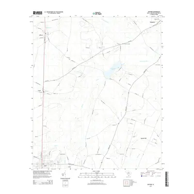
2014 Map of Gifford
USGS Topo · Published 2014About this map
The Coosawhatchie River and its myriad tributaries, including Black Cr and Brier Creek, define the drainage patterns of this lowcountry landscape near the Hampton and Hampton County border. This 2014 survey captures a rural South Carolina corridor where small settlements like Gifford, Lena, and Estill are connected by the Savannah Hwy and Luray Hwy. The presence of Lake George Warren and its surrounding parklands highlights the region's managed water resources. Local family history and land-use patterns are evident in labels such as Browning Cem and Speaks Mill, while the inclusion of Harpers Airport and Johnson Crossing marks the transportation infrastructure that serves these agricultural and residential communities. The network of secondary roads, such as Hiers Farm Rd and Goettee Trl, further illustrates the area's rural development and the integration of larger plantations and farms within the coastal plain.
Find a feature on this map
80 named features on this map. Tap any name to fly to it.
Don’t see what you’re looking for? This feature index may not catch every label — zoom into the map to look around manually.
Map Details
Editions of this 2014 Gifford Map
This is the sole edition of this map. No revisions or reprints were ever made.
Other maps of this area

1918 · Varnville
USGS Topo · 1:62,500

1919 · Pineland
USGS Topo · 1:62,500

1919 · Shirley
USGS Topo · 1:62,500

1920 · Peeples
USGS Topo · 1:62,500

1943 · Pineland
USGS Topo · 1:62,500

1943 · Peeples
USGS Topo · 1:62,500

1943 · Shirley
USGS Topo · 1:62,500

1944 · Varnville
USGS Topo · 1:62,500

1947 · Savannah
USGS Topo · 1:250,000

1948 · Savannah
USGS Topo · 1:250,000