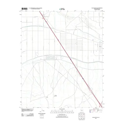
2011 Map of Gila Butte SE
USGS Topo · Published 2011About this map
Sacaton and the small settlement of Burns anchor this 2011 survey of the Pinal County desert floor. The landscape is defined by the contrast between the braided channel of the Gila River in the north and the rising peaks of the Sacaton Mountains to the south. Irrigation and transport infrastructure dominate the terrain, notably the Southside Canal Rd which parallels the natural waterway. The map captures a sophisticated network of tribal and local routes, including Casa Blanca Rd, Seed Farm Rd, and the Casa Blanca Interchange, illustrating the area's agricultural and transit-oriented development. To the east, specialized sites like the Skill Center Rd indicate the community infrastructure serving the region during this period.
Find a feature on this map
29 named features on this map. Tap any name to fly to it.
Don’t see what you’re looking for? This feature index may not catch every label — zoom into the map to look around manually.
Map Details
Editions of this 2011 Gila Butte SE Map
This is the sole edition of this map. No revisions or reprints were ever made.
Other maps of this area

1907 · Sacaton
USGS Topo · 1:62,500

1914 · Gila Butte
USGS Topo · 1:62,500

1917 · Gila Butte
USGS Topo · 1:62,500

1922 · Casa Grande
USGS Topo · 1:62,500

1922 · Signal Peak
USGS Topo · 1:62,500

1924 · Signal Peak
USGS Topo · 1:62,500

1924 · Casa Grande
USGS Topo · 1:62,500

1952 · Gila Butte SE
USGS Topo · 1:24,000

1952 · Sacaton Butte
USGS Topo · 1:24,000

1952 · Gila Butte NW
USGS Topo · 1:24,000