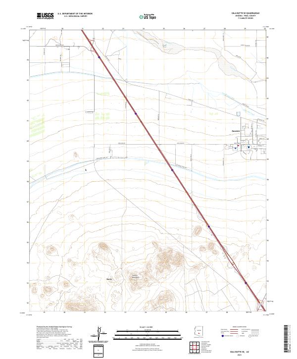
2021 Map of Gila Butte SE
USGS Topo · Published 2021About this map
Sacaton serves as a primary settlement within this desert corridor, where modern irrigation infrastructure meets the ancient path of the Gila River. The landscape is defined by the transition from the river's northern floodplains to the rugged elevations of the Sacaton Mountains in the south near Burns. A sophisticated network of water management is visible through the Casa Blanca Canal, Little-Gila Canal, and the accompanying Southside Canal Rd, illustrating the intensive agricultural development of the region. The map also highlights local infrastructure such as the Seed Farm Rd and the Skill Center Rd, which reflect the community's focus on land use and education. This 2021 survey provides a clear view of the Pinal County interior, showing how historical waterways and contemporary roadways like Indian Rte 1 and Gasline Rd navigate the arid terrain.
Find a feature on this map
34 named features on this map. Tap any name to fly to it.
Don’t see what you’re looking for? This feature index may not catch every label — zoom into the map to look around manually.
Map Details
Editions of this 2021 Gila Butte SE Map
This is the sole edition of this map. No revisions or reprints were ever made.
Other maps of this area

1907 · Sacaton
USGS Topo · 1:62,500

1914 · Gila Butte
USGS Topo · 1:62,500

1917 · Gila Butte
USGS Topo · 1:62,500

1922 · Casa Grande
USGS Topo · 1:62,500

1922 · Signal Peak
USGS Topo · 1:62,500

1924 · Signal Peak
USGS Topo · 1:62,500

1924 · Casa Grande
USGS Topo · 1:62,500

1952 · Gila Butte SE
USGS Topo · 1:24,000

1952 · Sacaton Butte
USGS Topo · 1:24,000

1952 · Gila Butte NW
USGS Topo · 1:24,000