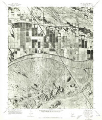
1971 Map of Gila Butte SE
USGS Topo · Published 1972About this map
The Gila River provides a sharp northern boundary to this Pinal County landscape, which transitions from irrigated agricultural grids into the high desert relief of the Sacaton Mountains. This 1971 orthophotomap uses aerial photography to capture the visual textures of the era, revealing the stark contrast between the darkened, water-rich squares of the northern farm tracts and the light-colored, alluvial fans of the southern mountains. The geometric precision of the irrigation network and the long, diagonal infrastructure cuts through the desert floor illustrate the scale of mid-century water management in the Arizona desert. These photogrammetric surveys are particularly valuable for documenting the exact footprint of desert reclamation and agricultural development before further modernization or suburban expansion altered the local topography.
Find a feature on this map
2 named features on this map. Tap any name to fly to it.
Don’t see what you’re looking for? This feature index may not catch every label — zoom into the map to look around manually.
Map Details
Editions of this 1971 Gila Butte SE Map
This is the sole edition of this map. No revisions or reprints were ever made.
Other maps of this area

1907 · Sacaton
USGS Topo · 1:62,500

1914 · Gila Butte
USGS Topo · 1:62,500

1917 · Gila Butte
USGS Topo · 1:62,500

1922 · Casa Grande
USGS Topo · 1:62,500

1922 · Signal Peak
USGS Topo · 1:62,500

1924 · Signal Peak
USGS Topo · 1:62,500

1924 · Casa Grande
USGS Topo · 1:62,500

1952 · Gila Butte SE
USGS Topo · 1:24,000

1952 · Sacaton Butte
USGS Topo · 1:24,000

1952 · Gila Butte NW
USGS Topo · 1:24,000