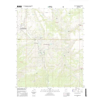
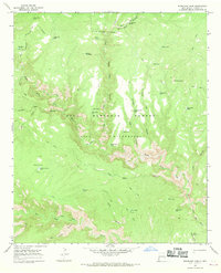
2017 Map of Gila Hot Springs
USGS Topo · Published 2017About this map
The Gila Cliff Dwellings National Monument stands as the primary cultural landmark at the northern edge of this territory, where the W Fork Gila River and E Fork Gila River converge. This 2017 survey details the rugged hydrologic network of the Gila National Forest, centered around the settlement of Gila Hot Springs. The landscape is defined by its numerous thermal and seasonal water sources, including the Lyons Hunting Lodge Hot Spring, Hidden Spring, and River Spring. To the south, the terrain rises toward Alum Mtn and the canyons of Apache Cr, while the remote settlement of El Rincon sits near the winding main stem of the Gila River. Local history and ranching roots are evident in named landmarks like Montoya Pasture and the intricate system of cattle tanks such as Picket Corral Tank and Split Tank.
Find a feature on this map
49 named features on this map. Tap any name to fly to it.
Don’t see what you’re looking for? This feature index may not catch every label — zoom into the map to look around manually.
Map Details
Editions of this 2017 Gila Hot Springs Map
This is the sole edition of this map. No revisions or reprints were ever made.
Other maps of this area

1911 · Alum Mountain
USGS Topo · 1:125,000

1913 · Alum Mountain
USGS Topo · 1:125,000

1954 · Clifton
USGS Topo · 1:250,000

1957 · Clifton
USGS Topo · 1:250,000

1958 · Clifton
USGS Topo · 1:250,000

1962 · Clifton
USGS Topo · 1:250,000
1965 · Copperas Peak
USGS Topo · 1:24,000
1965 · North Star Mesa
USGS Topo · 1:24,000
1965 · Middle Mesa
USGS Topo · 1:24,000
1965 · Woodland Park
USGS Topo · 1:24,000