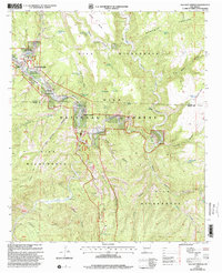
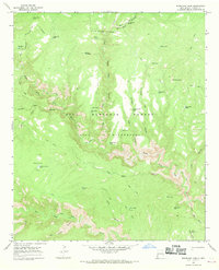
1999 Map of Gila Hot Springs
USGS Topo · Published 2002About this map
Gila Cliff Dwellings National Monument anchors the Northwest corner of this survey, where the Middle Fork Gila River and West Fork Gila River converge. The landscape is defined by its canyon systems and river forks, with the small settlement of Gila Hot Springs situated near the junction of the West and East forks. Evidence of ranching and early habitation is scattered throughout the Gila Wilderness, including the X S X Ranch, Lyons Lodge, and several graves near the river banks. A complex network of canyons such as Black Canyon, Tom Moore Canyon, and Alum Canyon cut through the high mesas, while the Heart Bar Wildlife Area protects the riparian corridors. This 1990s revision provides a clear record of land use within the Gila National Forest, showing infrastructure like the Visitor Center and Helipad alongside traditional landmarks like Picket Corral.
Find a feature on this map
49 named features on this map. Tap any name to fly to it.
Don’t see what you’re looking for? This feature index may not catch every label — zoom into the map to look around manually.
Map Details
Editions of this 1999 Gila Hot Springs Map
This is the sole edition of this map. No revisions or reprints were ever made.
Other maps of this area

1911 · Alum Mountain
USGS Topo · 1:125,000

1913 · Alum Mountain
USGS Topo · 1:125,000

1954 · Clifton
USGS Topo · 1:250,000

1957 · Clifton
USGS Topo · 1:250,000

1958 · Clifton
USGS Topo · 1:250,000

1962 · Clifton
USGS Topo · 1:250,000
1965 · Copperas Peak
USGS Topo · 1:24,000
1965 · North Star Mesa
USGS Topo · 1:24,000
1965 · Middle Mesa
USGS Topo · 1:24,000
1965 · Woodland Park
USGS Topo · 1:24,000