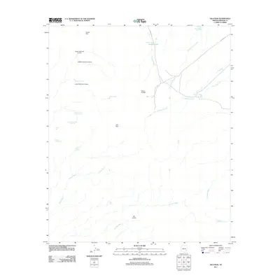
2011 Map of Gila Peak
USGS Topo · Published 2011About this map
Gila Peak serves as the central landmark for this high-desert landscape in eastern Arizona, where a complex network of seasonal drainages and canyons defines the topography. The map records a series of vital water sources in an arid environment, including Ninemile Tank, Sevenmile Tank, and the uniquely named Arsenic Tank. Significant topographic formations like Hooker Gap and the geological breach at Hole in the Wall provide natural corridors through the terrain. Evidence of ranching or early industrial activity appears at the Day Mine Windmill and Head-of-Day Mine Tanks in the southern reaches. The drainage system is particularly well-documented, showing the convergence of South Fork Ash Creek and Sevenmile Creek, along with the deep incisions of Upper Fishhook Canyon and its middle and lower counterparts. Transportation is represented by the paths of Indian Rte 18 and Indian Rte 19, which navigate the rugged washes.
Find a feature on this map
27 named features on this map. Tap any name to fly to it.
Don’t see what you’re looking for? This feature index may not catch every label — zoom into the map to look around manually.
Map Details
Editions of this 2011 Gila Peak Map
This is the sole edition of this map. No revisions or reprints were ever made.
Other maps of this area

1954 · Clifton
USGS Topo · 1:250,000

1954 · Mesa
USGS Topo · 1:250,000

1957 · Mesa
USGS Topo · 1:250,000

1957 · Clifton
USGS Topo · 1:250,000

1958 · Clifton
USGS Topo · 1:250,000

1958 · Mesa
USGS Topo · 1:250,000

1960 · Mesa
USGS Topo · 1:250,000

1960 · Bylas
USGS Topo · 1:62,500

1960 · Fort Thomas
USGS Topo · 1:62,500

1962 · Clifton
USGS Topo · 1:250,000