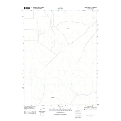
2011 Map of Gilbert Creek NE
USGS Topo · Published 2011About this map
Red Butte and Antelope Butte serve as the primary topographical landmarks in this high-desert region of Lander County. This 2011 survey by the U.S. Geological Survey illustrates the vast, open character of the Great Basin landscape, where a network of unpaved roads and tracks provides the only access through the drainage basins. The map captures a moment of modern land management and quiet geography, characterized more by its hydrographic patterns and the absence of permanent settlements than by industrial or urban development. Researchers and locals can trace the subtle natural drainage lines that define the territory between these two namesake buttes, offering a detailed look at the rural Nevada backcountry just before the turn of the decade.
Find a feature on this map
2 named features on this map. Tap any name to fly to it.
Don’t see what you’re looking for? This feature index may not catch every label — zoom into the map to look around manually.
Map Details
Editions of this 2011 Gilbert Creek NE Map
This is the sole edition of this map. No revisions or reprints were ever made.
Other maps of this area

1932 · Sonoma Range
USGS Topo · 1:250,000

1939 · Sonoma Range
USGS Topo · 1:250,000

1955 · Millett
USGS Topo · 1:250,000

1955 · Winnemucca
USGS Topo · 1:250,000

1958 · Winnemucca
USGS Topo · 1:250,000

1959 · Millett
USGS Topo · 1:250,000

1961 · The Cedars
USGS Topo · 1:62,500

1961 · Mt. Moses
USGS Topo · 1:62,500

1962 · Winnemucca
USGS Topo · 1:250,000

1969 · Manhattan Mtn
USGS Topo · 1:24,000