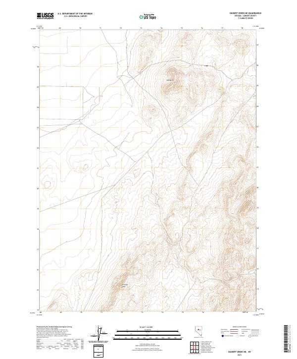
2021 Map of Gilbert Creek NE
USGS Topo · Published 2021About this map
Red Butte and Antelope Butte dominate the landscape of this high-desert region in Lander County, Nevada. This survey detail reveals the characteristic basin-and-range topography, defined by North American Datum of 1983 (NAD83) grid systems including t25n r41e, t24n r41e, and t23n r42e. The map illustrates the complex public land survey system lines that organize this terrain, which is primarily characterized by steep elevation changes and isolated peaks. Without major settlements or roads, the focus remains on the natural relief and the cadastral boundaries that segment this portion of the Great Basin. The intricate contour lines provided by the National Elevation Dataset highlight the distinct isolation of these two prominent buttes from the surrounding desert floor.
Find a feature on this map
9 named features on this map. Tap any name to fly to it.
Don’t see what you’re looking for? This feature index may not catch every label — zoom into the map to look around manually.
Map Details
Editions of this 2021 Gilbert Creek NE Map
This is the sole edition of this map. No revisions or reprints were ever made.
Other maps of this area

1932 · Sonoma Range
USGS Topo · 1:250,000

1939 · Sonoma Range
USGS Topo · 1:250,000

1955 · Millett
USGS Topo · 1:250,000

1955 · Winnemucca
USGS Topo · 1:250,000

1958 · Winnemucca
USGS Topo · 1:250,000

1959 · Millett
USGS Topo · 1:250,000

1961 · The Cedars
USGS Topo · 1:62,500

1961 · Mt. Moses
USGS Topo · 1:62,500

1962 · Winnemucca
USGS Topo · 1:250,000

1969 · Manhattan Mtn
USGS Topo · 1:24,000