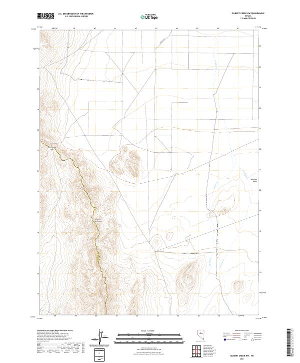
2021 Map of Gilbert Creek NW
USGS Topo · Published 2021About this map
The Augusta Mountains dominate the western portion of this landscape, their ridges forming the natural boundary between Churchill and Lander Counties. This transition between high ground and the drainage systems of Antelope Valley to the east reflects the classic Basin and Range topography of the region. The map tracks the passage through Cain Spring Pass, a significant local navigational point in the high terrain. Below the peaks, the hydrology is defined by seasonal waterways like Antelope Cr and Gilbert Cr, which weave through the flats and illustrate the complex drainage patterns of the high desert. The survey provides precise details on the land management grid, including numerous township and range lines that have governed local property and grazing rights since the early settlement of the Great Basin.
Find a feature on this map
13 named features on this map. Tap any name to fly to it.
Don’t see what you’re looking for? This feature index may not catch every label — zoom into the map to look around manually.
Map Details
Editions of this 2021 Gilbert Creek NW Map
This is the sole edition of this map. No revisions or reprints were ever made.
Other maps of this area

1932 · Sonoma Range
USGS Topo · 1:250,000

1939 · Sonoma Range
USGS Topo · 1:250,000

1955 · Millett
USGS Topo · 1:250,000

1955 · Winnemucca
USGS Topo · 1:250,000

1958 · Winnemucca
USGS Topo · 1:250,000

1959 · Millett
USGS Topo · 1:250,000

1961 · Cain Mountain
USGS Topo · 1:62,500

1961 · Mt. Moses
USGS Topo · 1:62,500

1962 · Winnemucca
USGS Topo · 1:250,000

1966 · Shoshone Meadows
USGS Topo · 1:62,500