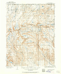
1905 Map of Gilbert Peak
USGS Topo · Published 1963About this map
The Uinta Mountains dominate this high-altitude survey, representing the wilderness at the turn of the century when federal land management was just beginning to take shape. Surveyed in the early 1900s, the map identifies the early boundaries of Wasatch National Forest and Ashley National Forest. The landscape is a complex network of glacial basins and peaks, including Kings Peaks and Gilbert Peak, which feed the headwaters of the Uinta River and Yellowstone Creek.
Find a feature on this map
42 named features on this map. Tap any name to fly to it.
Don’t see what you’re looking for? This feature index may not catch every label — zoom into the map to look around manually.
Map Details
Editions of this 1905 Gilbert Peak Map
2 editions found
Other maps of this area

1885 · Ashley
USGS Topo · 1:250,000

1885 · Uinta
USGS Topo · 1:250,000

1901 · Hayden Peak
USGS Topo · 1:125,000

1903 · Hayden Peak
USGS Topo · 1:125,000

1905 · Gilbert Peak
USGS Topo · 1:125,000

1906 · Gilbert Peak
USGS Topo · 1:125,000

1906 · Marsh Peak
USGS Topo · 1:125,000

1908 · Marsh Peak
USGS Topo · 1:125,000

1917 · Vernal
USGS Topo · 1:125,000

1939 · Duchesne
USGS Topo · 1:125,000