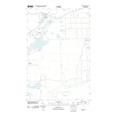
2010 Map of Gilbert
USGS Topo · Published 2010About this map
The Mesabi Range iron mining landscape is prominent throughout this 2010 study of the area surrounding Gilbert. The town's proximity to massive industrial excavations is clear, with the Gilbert Mine and Schley Mine situated just east of the main settlement. Further south, the former townsite of Sparta sits near the Sparta-Matta Mine and Genoa Mine, illustrating how mining operations dictated the settlement patterns of Saint Louis County. Hydrological features are well-defined, including Ely Lake, Leaf Lake, and the winding course of the Embarrass River which flows toward the Saint Louis River. Aviation history is represented by the Sky Harbor Seaplane Base on the shores of Ely Lake, while the Eveleth-Virginia Municipal Airport serves the broader region. This map provides a detailed view of the infrastructure supporting both the industrial and recreational life of the Iron Range, from the Eveleth Scout Camp at Pleasant Lake to the various dams and residential roads serving these lakefront communities.
Find a feature on this map
67 named features on this map. Tap any name to fly to it.
Don’t see what you’re looking for? This feature index may not catch every label — zoom into the map to look around manually.
Map Details
Editions of this 2010 Gilbert Map
This is the sole edition of this map. No revisions or reprints were ever made.
Other maps of this area

1950 · Biwabik
USGS Topo · 1:24,000

1950 · Mc Kinley
USGS Topo · 1:24,000

1951 · Biwabik
USGS Topo · 1:24,000

1951 · Mc Kinley
USGS Topo · 1:24,000

1951 · Palo
USGS Topo · 1:24,000

1951 · Gilbert
USGS Topo · 1:24,000

1951 · Eveleth
USGS Topo · 1:24,000

1951 · Virginia
USGS Topo · 1:24,000

1951 · Central Lakes
USGS Topo · 1:24,000

1951 · Zim
USGS Topo · 1:24,000