
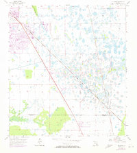
1957 Map of Gilchrist
USGS Topo · Published 1958About this map
The low-lying wetlands and pine flatwoods of the Florida Gulf Coast interior define this mid-century survey along the Charlotte and Lee County line. Development at this time is concentrated in the northwest corner at South Punta Gorda Heights, while much of the landscape remains a complex network of marshes and scattered hammocks. The Atlantic Coast Line corridor cuts a sharp diagonal southeast across the quadrangle, serving as the primary infrastructure spine for the region. Further east, an Atlantic Coast Line Railroad Grade indicates the evolution of timber or phosphate transport routes. Notable water features include the South Prong Alligator creek and a singular Flowing Well, suggesting the importance of artesian water sources in this permeable landscape before widespread drainage and residential expansion reached this section of Southwest Florida.
Find a feature on this map
7 named features on this map. Tap any name to fly to it.
Don’t see what you’re looking for? This feature index may not catch every label — zoom into the map to look around manually.
Map Details
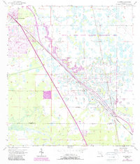
Editions of this 1957 Gilchrist Map
3 editions found
Other maps of this area

1956 · Cleveland
USGS Topo · 1:24,000

1956 · Punta Gorda SE
USGS Topo · 1:24,000

1956 · Bermont
USGS Topo · 1:24,000

1956 · West Palm Beach
USGS Topo · 1:250,000

1956 · Tampa
USGS Topo · 1:250,000

1956 · Charlotte Harbor
USGS Topo · 1:250,000

1957 · West Palm Beach
USGS Topo · 1:250,000

1957 · Tuckers Corner
USGS Topo · 1:24,000

1957 · Punta Gorda
USGS Topo · 1:24,000

1958 · West Palm Beach
USGS Topo · 1:250,000