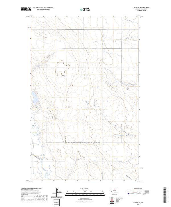
2024 Map of Gildford NE
USGS Topo · Published 2024About this map
Sage Creek meanders through the western reaches of this Montana landscape, cutting a path through the high plains north of the Milk River valley. The terrain is defined by a series of drainage features including Spring Coulee, Dry Lake Coulee, O'Brien Coulee, and Alkali Coulee, which illustrate the hydraulic patterns of this arid region. These coulees serve as vital landmarks in an area otherwise characterized by vast open country and sections of the Public Land Survey System, including t34n r11e and t35n r10e. Modern infrastructure is represented by State Hwy 449, which provides the primary north-south corridor through these remote rangelands. This 2024 data represents the contemporary topography of Hill County, where the land remains largely agricultural and sparsely settled, preserving the historical township and range boundaries established during the initial western surveys.
Find a feature on this map
13 named features on this map. Tap any name to fly to it.
Don’t see what you’re looking for? This feature index may not catch every label — zoom into the map to look around manually.
Map Details
Editions of this 2024 Gildford NE Map
This is the sole edition of this map. No revisions or reprints were ever made.
Other maps of this area

1906 · Kremlin
USGS Topo · 1:62,500

1920 · Gildford
USGS Topo · 1:125,000

1943 · Gildford
USGS Topo · 1:125,000

1954 · Shelby
USGS Topo · 1:250,000

1958 · Shelby
USGS Topo · 1:250,000
1969 · Sage Lake
USGS Topo · 1:24,000

1969 · Gildford NE
USGS Topo · 1:24,000

1969 · Gildford NW
USGS Topo · 1:24,000

1969 · Hingham
USGS Topo · 1:24,000
1969 · Gildford
USGS Topo · 1:24,000