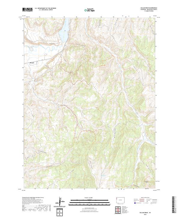
2022 Map of Gillam Draw
USGS Topo · Published 2022About this map
The White River winds through the northwestern corner of this landscape, passing the eastern edge of Rangely. The terrain is defined by a dense network of erosional features, including Gillam Draw, Big Canyon, and Red Hill Canyon, which carve through the high plateaus of Rio Blanco County. These drainage patterns illustrate the complex topography leading toward the prominent Cathedral Bluffs in the south.
Find a feature on this map
31 named features on this map. Tap any name to fly to it.
Don’t see what you’re looking for? This feature index may not catch every label — zoom into the map to look around manually.
Map Details
Editions of this 2022 Gillam Draw Map
This is the sole edition of this map. No revisions or reprints were ever made.
Other maps of this area

1907 · Rangely
USGS Topo · 1:125,000

1910 · Rangely
USGS Topo · 1:125,000

1954 · Vernal
USGS Topo · 1:250,000

1956 · Grand Junction
USGS Topo · 1:250,000

1958 · Vernal
USGS Topo · 1:250,000

1959 · Grand Junction
USGS Topo · 1:250,000

1960 · Vernal
USGS Topo · 1:250,000

1960 · Grand Junction
USGS Topo · 1:250,000

1962 · Grand Junction
USGS Topo · 1:250,000

1962 · Rangely NE
USGS Topo · 1:24,000