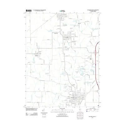
2012 Map of Gillespie South
USGS Topo · Published 2012About this map
Staunton anchors the southern portion of this Macoupin County landscape, where the legacy of regional industry is etched into the terrain. Just north of town, the Mine Number 7 Reservoir and Number 7 Mine Ln point to the area’s coal mining history. This industrial character is further reflected in the transport network, including Smutzlar Siding and Staunton Siding, which historically facilitated the movement of goods between small hubs like Benld, Wilsonville, and Mount Clare.
Find a feature on this map
136 named features on this map. Tap any name to fly to it.
Don’t see what you’re looking for? This feature index may not catch every label — zoom into the map to look around manually.
Map Details
Editions of this 2012 Gillespie South Map
This is the sole edition of this map. No revisions or reprints were ever made.
Other maps of this area

1912 · Gillespie
USGS Topo · 1:62,500

1915 · Gillespie
USGS Topo · 1:62,500

1915 · Mount Olive
USGS Topo · 1:62,500

1927 · Edwardsville
USGS Topo · 1:62,500

1932 · Edwardsville
USGS Topo · 1:62,500

1937 · New Douglas
USGS Topo · 1:48,000

1944 · New Douglas
USGS Topo · 1:62,500

1944 · Mount Olive
USGS Topo · 1:62,500

1954 · Worden
USGS Topo · 1:24,000
1954 · Prairietown
USGS Topo · 1:24,000