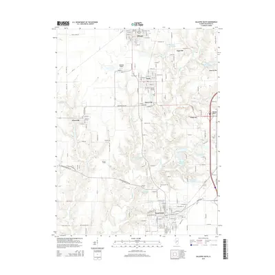
2015 Map of Gillespie South
USGS Topo · Published 2015About this map
Staunton and the surrounding coal-country communities anchor this mid-2010s survey of southern Macoupin County. The map details a dense cluster of towns including Gillespie, Benld, Sawyerville, and Wilsonville, each linked by a grid of rural roads and historical industrial footprints. The landscape is defined by its water management and cemeteries, with several namesake burial grounds such as Old Saint Michaels Cem and the Holy Assumption Russian Orthodox Creek Cem serving as significant genealogical markers.
Find a feature on this map
168 named features on this map. Tap any name to fly to it.
Don’t see what you’re looking for? This feature index may not catch every label — zoom into the map to look around manually.
Map Details
Editions of this 2015 Gillespie South Map
This is the sole edition of this map. No revisions or reprints were ever made.
Other maps of this area

1912 · Gillespie
USGS Topo · 1:62,500

1915 · Gillespie
USGS Topo · 1:62,500

1915 · Mount Olive
USGS Topo · 1:62,500

1927 · Edwardsville
USGS Topo · 1:62,500

1932 · Edwardsville
USGS Topo · 1:62,500

1937 · New Douglas
USGS Topo · 1:48,000

1944 · New Douglas
USGS Topo · 1:62,500

1944 · Mount Olive
USGS Topo · 1:62,500

1954 · Worden
USGS Topo · 1:24,000
1954 · Prairietown
USGS Topo · 1:24,000