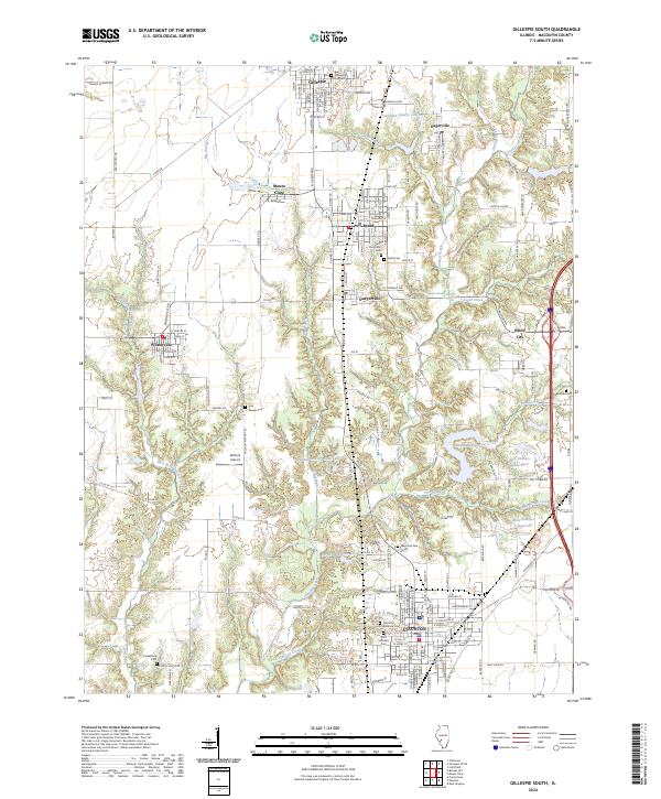
2024 Map of Gillespie South
USGS Topo · Published 2024About this map
Staunton and Gillespie anchor this survey of Macoupin County, illustrating the dense network of small municipalities and rural cemeteries that define the region. The landscape is deeply carved by Cahokia Creek and its tributaries, including Blue Branch and Ginseng Creek, which separate the agricultural uplands from the clusters of residential development in Benld and Sawyerville. This modern survey details the evolution of local infrastructure, from the small-scale aviation at Willhoit Airport to the industrial legacy represented by the Mine Number 7 Reservoir. Genealogists will find significant value in the precise locations of family and community resting places, such as the Sawyer Cem, Funderburk Cem, and the Holy Dormition Cem. The map further captures the periphery of larger settlements like White City and Wilsonville, providing a comprehensive view of the corridor between these historic Illinois coal towns.
Find a feature on this map
88 named features on this map. Tap any name to fly to it.
Don’t see what you’re looking for? This feature index may not catch every label — zoom into the map to look around manually.
Map Details
Editions of this 2024 Gillespie South Map
This is the sole edition of this map. No revisions or reprints were ever made.
Other maps of this area

1912 · Gillespie
USGS Topo · 1:62,500

1915 · Gillespie
USGS Topo · 1:62,500

1915 · Mount Olive
USGS Topo · 1:62,500

1927 · Edwardsville
USGS Topo · 1:62,500

1932 · Edwardsville
USGS Topo · 1:62,500

1937 · New Douglas
USGS Topo · 1:48,000

1944 · New Douglas
USGS Topo · 1:62,500

1944 · Mount Olive
USGS Topo · 1:62,500

1954 · Worden
USGS Topo · 1:24,000
1954 · Prairietown
USGS Topo · 1:24,000