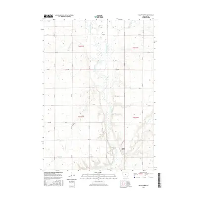
2015 Map of Gillett Grove
USGS Topo · Published 2015About this map
Gillett Grove sits at the heart of this Clay County landscape, where the Little Sioux River meanders through a valley defined by significant water systems like the Lost Island Outlet and Lexington Cr. The terrain reflects the agricultural grid of northern Iowa, with Section lines established by the Public Land Survey System (PLSS) across townships t96n r36w and t95n r35w. This 2015 edition provides a modern view of rural life where legacy features remain central to the community's footprint.
Find a feature on this map
35 named features on this map. Tap any name to fly to it.
Don’t see what you’re looking for? This feature index may not catch every label — zoom into the map to look around manually.
Map Details
Editions of this 2015 Gillett Grove Map
This is the sole edition of this map. No revisions or reprints were ever made.
Other maps of this area
1954 · Fairmont
USGS Topo · 1:250,000
1954 · Fort Dodge
USGS Topo · 1:250,000
1957 · Fort Dodge
USGS Topo · 1:250,000
1958 · Fort Dodge
USGS Topo · 1:250,000
1958 · Fairmont
USGS Topo · 1:250,000
1966 · Spencer
USGS Topo · 1:24,000
1966 · Gillett Grove
USGS Topo · 1:24,000
1966 · Greenville
USGS Topo · 1:24,000
1966 · Dickens
USGS Topo · 1:24,000
1971 · Sioux Rapids
USGS Topo · 1:24,000