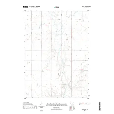
2018 Map of Gillett Grove
USGS Topo · Published 2018About this map
The Little Sioux River meanders through the heart of this Clay County landscape, defining the agricultural character of the region. Near the southern edge of the survey, the small community of Gillett Grove sits at the confluence where Elk Cr meets the main river valley. This area is characterized by a dense network of section-line roads and several vital watercourses, including the Lost Island Outlet, which feeds into the river from the north.
Find a feature on this map
29 named features on this map. Tap any name to fly to it.
Don’t see what you’re looking for? This feature index may not catch every label — zoom into the map to look around manually.
Map Details
Editions of this 2018 Gillett Grove Map
This is the sole edition of this map. No revisions or reprints were ever made.
Other maps of this area

1954 · Fairmont
USGS Topo · 1:250,000

1954 · Fort Dodge
USGS Topo · 1:250,000

1957 · Fort Dodge
USGS Topo · 1:250,000

1958 · Fort Dodge
USGS Topo · 1:250,000

1958 · Fairmont
USGS Topo · 1:250,000

1966 · Spencer
USGS Topo · 1:24,000

1966 · Gillett Grove
USGS Topo · 1:24,000

1966 · Greenville
USGS Topo · 1:24,000

1966 · Dickens
USGS Topo · 1:24,000

1971 · Sioux Rapids
USGS Topo · 1:24,000